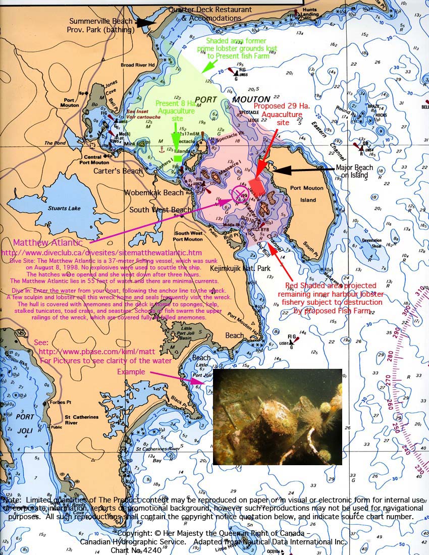
Maps and Charts
The images below illustrate the proposed location in Port Mouton Bay for a second fish farm. When a moratorium on new fish farms for the Bay was announced, the project proponent withdrew this proposal. However, these images shows what might have happened - if the community had not acted decisively to oppose it.
The proposed fish farm, shown on these images as a rectangle, was on the west side of Port Mouton Island. The site would have occupied a bay that includes Kejimkujik National Seaside Park, Summerville Beach and Provincial Park, South West Port Mouton Beach, Carters Beach (protected beach), Hunts Point Beach and White Point Beach.